
Arizona
AZGenWeb

Cochise
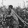
Cotton Picker
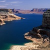
Lake Powell
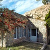
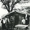
Shaw House
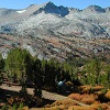
White Mountains
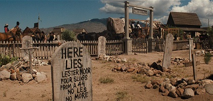
Boot Hill
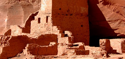
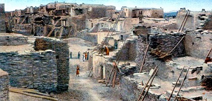
Cave Dwellings
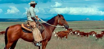
Cowboy
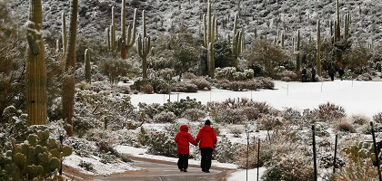
Snow in the Desert
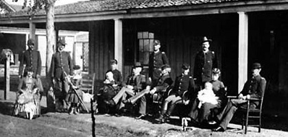
Fort Verde Porch
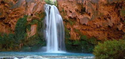
Havasu Waterfalls
Hopi Pueblo
Red Rocks
Jerome
Mogollon
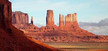
Monument Valley
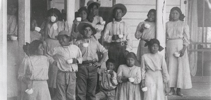
Navajo Children
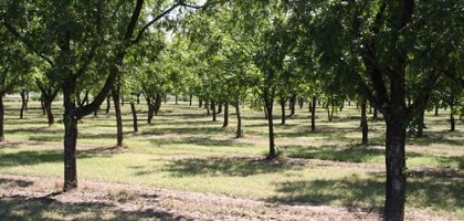
Pecan Orchard
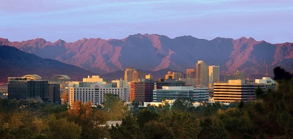
Phoenix
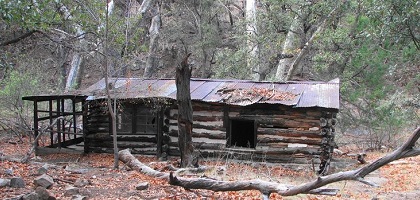
Ramsey Cabin
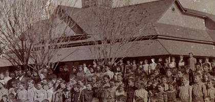
School House
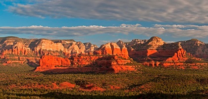
Sedona

Store
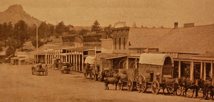
Prescott's Whiskey Row
"Some claim the Southwestern state's name comes from the
Spanish zona arida, translated as "arid zone."
"Another version states it
comes from a Tohono O'odham village about 25 miles sowthwest of Nogales, called
Ali-Shonak, meaning "Place of the Small Spring." Ali-Shonak didn't easily roll
off Spanish tongues, so the Spanish corrupted it to Arizonac or Arisona. When
the Americans arrived more than a century later, following the 1854 Gadsden
Purchase, they corrupted it again to Arizona.
"The late Don Garate, chief
of interpretation and historian at Tumacacori National Historical Park, disputed
that claim. He stated the name originated from the Basque term arizonac,
translated as the "good oak trees."
"In 1736, when boulders of silver,
some reportedly as large as 4,000 pounds, where discoverd near Ali-Shonak, a
legion of miners or gambusinos converged there. Given the region's abundant oak
trees, Basque residents called the place Arizona.
"Garate noted at least
a dozen other places in teh New World with the name Arizona, including in
Argentina, Brazil, Honduras and Columbia. Large numbers of Basque lived in all
those areas, among the oak trees, which provided the acorns the Basques fed to
their pigs, as they had done in their home country of Spain."
Source: True West magazine, Sep 2014 issue, page 110
Arizona includes part of the Colorado Plateau and part of the open basin region to the south.
The earliest human inhabitants of Arizona, of whom there is any trace, were a
people similar in habits to the Hopi Indians who still dwell in the pueblos or
villages of the plateau north of the Little Colorado River. Many evidences
remain to show that these were an agricultural people and possessed a rude sort
of civilization. In the canyons of the mountain and plateau regions are hundreds
of cliff dwellings built of stone under the projecting ledges of rock. These
contain pottery, ornaments, rude stone implements, and often human skeletons. In
the valleys of the desert regions are the ruins of many villages built of clay,
also ancient irrigating canals which show that these people understood raising
crops in a dry climate. Even before the time of Columbus this region supported a
large population, but, for some unknown reason, these dwellings had been
abandoned long before the first Spanish explorers visited what is now Arizona.
The attention of white men was first turned to Arizona in the early part of
the sixteenth century. The Spaniards, who had conquered Mexico, heard wonderful
tales of the marvelous wealth of the "Seven Cities of Cibola," which were
said to be situated somewhere in the north. In 1539, the Viceroy of Mexico sent
Marcos de Niza, a Franciscan friar, to see if he could find these wonderful
cities. De Niza, with his party, crossed the present boundary of Arizona
somewhere west of the present site of Nogales, and was received in a friendly
manner by the Pima Indians along the Gila River. Traveling northeastward across
the Little Colorado River, he came in sight of what he supposed to be Cibola,
but the inhabitants were so hostile that he returned to Mexico without further
investigation.
Thus the first exploration of Arizona occurred about the same time that the French were exploring the St. Lawrence, and long before the English made tlieir first settlements in Virginia.
When Marcos de Niza returned to Mexico, he told such a wonderful story of what he had seen, that, in 1540, another expedition was sent out under Francisco Coronado, who followed nearly the same route as did Marcos de Niza. On the way, he camped near the present site of Florence, and saw the Casa Grande, one of the ancient dwellings mentioned above. At that time it was already deserted and partly destroyed, but the walls are standing there yet. When Coronado reached Cibola, instead of rich cities full of gold and jewels, he found only a few poor Indian pueblos, some of which are still standing and inhabited. After subduing these Indians and sending out various exploring parties, one of which discovered the Grand Canyon of the Colorado, Coronado returned, sadly disappointed. But though he had found no treasure, he had claimed the country for Spain and had opened the way for the missionaries, who now began to spread Christianity among the Indians.
For a long time the missionaries were hampered by the hostilities of the Apaches, who prevented them from making many permanent settlements. About 1732 they founded the mission of San Xavier, which still stands a few miles south of Tucson. Tucson was settled probably about the same time.
Arizona remained under Spanish rule until 1821, when Mexico gained her independence. In 1816, during the war between the United States and Mexico, General Kearny, with his dragoons, crossed the southern part of what is now Arizona, following the Gila River to its junction with the Colorado, on his way to California.
Following Kearny, in the same year, came a battalion of Mormon troops who entered the present bounds of Arizona near the southeast corner, and, following the Gila and San Pedro rivers, crossed the Colorado near what is now Yuma, establishing the first wagon route across the southern Cordilleras.
At the close of the Mexican War, in 1848, the region became United States territory, being included within the boundaries of New Mexico, with the Gila River as its southern limit.
In 1849, the discovery of gold in California attracted people from all over the world. Thousands from the United States and Mexico crossed Arizona on their way to the new mines, taking advantage of the route opened by the Mormon Battalion. Many of these people returned later and settled in Arizona.
The region south of the Gila was seen to afford an excellent route for a railroad to the Pacific, and was said to be rich in minerals. So in 1854 the United States Government, through James Gadsden, minister to Mexico, purchased this tract from Mexico, and the present boundary was established.
In 1863, in response to petitions from the settlers, Congress separated the Territory of Arizona from New Mexico and gave it a territorial government of its own.
For a long time the chief attraction to settlers was the wealth of the mines, but when the Apaches became less troublesome and were finally subdued, the people began to recognize the opportunities for agriculture. In 1877, the Mormons established several successful farming colonies in the valleys of the Little Colorado and Salt rivers.
In 1881 the Southern Pacific Railway was completed across the southern part of the Territory, and two years later the Atlantic and Pacific Railway, now part of the Santa Fe system, was extended to the Colorado River across the northern part. Having thus secured facilities for immigration and the marketing of products, permanent progress was assured.
Surface. — Arizona may be divided into three physiographic regions. The first of these, the plateau region, occupies the northeastern portion and is part of the great Colorado Plateau.
The second, or mountain region, adjoins the plateau region on the southwest, and is a broad belt of short, nearly parallel mountain ranges, extending diagonally from the Colorado River in Mohave County to the southeast corner of the Territory. This region is from 70 to 150 miles wide.
The third, or desert region, includes the remainder of the Territory, and lies south and west of a line from Mohave City on the Colorado River, past Phoenix, Florence, and Tucson, to Nogales on the Mexican border.
Plateau Region. — The portion of Arizona which belongs to the great Colorado Plateau is an elevated region having an area of nearly 45,000 square miles. Its surface averages about 7000 feet above sea level and slopes slightly toward the north. At its southern limit it drops away abruptly in a long line of steep cliffs. On the map trace this line, beginning with the Grand Wash Cliffs, following the Aubrey Cliffs and the Mogollon Mesa to the southern border of the White Mountains. Seligman, Ash Fork, Pine, and Payson are near the edge of the plateau. Find these places on the map. North of Payson the edge of the plateau is known locally as the "Mogollon Rim," and stands from 1200 to 2000 feet high. From below, this line of cliffs looks like a great range of mountains, but from the top of the rim the surface stretches away like a level plain. However, the surface is not so smooth as it appears in a general view, for in traveling over it one finds it cut by innumerable deep canyons which have been slowly carved out by the streams of the region at the same time that the plateau was being slowly pushed upward.
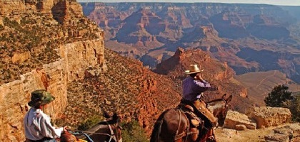
The Colorado River itself has cut, through the plateau, the most remarkable stream gorge in the world. That portion of its canyon which lies within Arizona is over 200 miles in length and from 2000 to 6000 feet deep, its walls rising almost vertically from the river. So many tourists visit this canyon to enjoy the grandeur of its scenery, that a railroad has been built from Williams to the edge of the canyon for their accommodation.
The canyons of the tributary streams are similar to the Grand Canyon, but smaller because they carry a smaller volume of water. These canyons make travel in the plateau region very difficult, as it is not easy to cut a road down their steep walls, and it is frequently necessary to go a long way around in order to cross them.
The plateau is largely made up of limestones and sandstones lying in nearly horizontal layers, as can be seen in the walls of the Grand Canyon and its branches. In many places, however, molten lava has been forced up from below through fissures in the rocks, and, spreading out upon the surface, has cooled in great sheets.
North of Flagstaff are the San Francisco Mountains, the highest peaks in Arizona. Find them on the map. These great peaks are the remains of an extinct volcano, and consist of lava and cinders which have been forced up through the crater, and later have been worn and carved by rain and weather. In their neighborhood are many smaller craters and cinder cones, piled on top of the level sedimentary rock of the plateau. The White Mountains on the southern edge of the plateau were formed in a similar way.
The region northeast of the Little Colorado River is largely a desert for lack of sufficient rainfall, but along the rim of the plateau there is a great belt of pine timber covering an area of six thousand square miles, being the largest unbroken pine forest in the United States.
Forest regions are of great importance, as they prevent the washing away of the soil, and, by retaining the rain water, regulate the flow of the streams, preventing floods and maintaining the flow during dry seasons. In order to protect the timber from destruction by fires or by over-grazing (which kills the young trees), and to regulate the cutting of timber, the United States Government has made forest reserves of this and other timbered regions of Arizona, and appoints rangers to ride through and take care of them.
Mountain Region. — This broad belt of territory is continuous with the Basin region of Nevada and Utah on the one hand, and with the Sierra Madre of Mexico on the other. It is a region of nearly parallel mountain ranges, none of which are over fifty miles long, and few rise over 8000 feet above sea level. The trend of these ranges is, for the most part, from northwest to southeast, but in the southeastern part of the zone they approach more nearly a north and south direction. Locate on the map Black Mountains, Hualpai Mountains, Juniper Mountains, Black Hills, Bradshaw Mountains, Mazatzal Range, Pinal Mountains, Superstition Mountains, Santa Catalina Mountains, Galiuro Mountains, Santa Rita Mountains, Chiricahua Mountains, and Huachuca Mountains.
These ranges are separated by valleys which are deeply filled with sediment washed down from the mountains on either side. The mountains have been formed by the uplifting and tilting of great blocks of old sedimentary rocks, accompanied by outflows of lava through fissures. Long weathering has worn away so much of the rock that the ranges are very rugged.
The mountains must have risen very slowly, for we see that the principal streams of the region, the Salt and Gila rivers, have cut their channels directly across the ranges. The tributaries of these streams drain the valleys between the ranges.
The uplifts have brought to the surface many different kinds of rock. Various minerals have been forced into the fissures, and the veins thus formed have been exposed by erosion, making this a very rich mining region, both in quantity and variety of minerals.
The presence of the mineral wealth has determined the location of many cities and towns in this belt. Note on the map. Chloride, Kingman, Prescott, Jerome, Congress, Mayer, Globe, Tombstone, Bisbee, Nogales, Douglas, and Naco.
The rainfall of the mountain region is not so great as that of the plateau, hence there is less plant life. Still the valleys and canyons support a growth of cottonwood, ash, sycamore, and walnut, while the slopes are covered with shrubs such as manzanita and scrub oak, the latter furnishing winter food for range cattle. At higher levels are found junipers and Arizona cypress, valuable for fuel and for mine timbers, while those ranges which reach an altitude of 6500 to 7500 feet are covered with pine timber.
Desert Region. — This portion of Arizona is characterized by short, parallel ranges of low mountains, rising abruptly from broad, level, arid plains. These mountains look as though they were half buried, which, in fact, is really the case. The broad plains have been formed of material which has been washed down from the mountains from time to time by rainstorms, and spread out in sheets over the valleys. Although the region is arid, it is subject to violent rainstorms occurring at long intervals, each storm being confined to a small area. In the course of years, each part of the region is thus visited. Now one of these "cloudbursts," as the miners call them, sweeps away the loose soil from the mountain sides, where it receives no protection from the sparse vegetation, and the gathering water roars down the canyons in foaming torrents, carrying sand, clay, gravel, and even large bowlders far out upon the plain. In this manner, little by little, the valley is filled, for the rivers have neither volume enough nor slope enough to carry the sediment away. In some of these valleys, wells have shown the sediment to have a very great depth.
On account of the low elevation of the desert region,
the rainfall is scanty, and the existence of plants depends upon their ability
to resist drought. During the short rainy seasons the desert is usually covered
with low plants whose brilliant flowers form masses of color often miles in
extent. All these tender plants must quickly mature the seed which is to tide
over the long months of drought which are to follow. The only perennial plants
of the region are those which are able to retain moisture for long periods.
Along the Colorado River, from Yuma north, the tree yucca is a
characteristic plant. Farther east, the saguaro, or giant cactus, is a
conspicuous feature of the landscape, and other species of cactus are plentiful,
especially upon the lower slopes of the mountains. Over the greater part of the
region grows the creosote bush, often wrongly called greasewood.
Along the washes, or beds of wet-weather streams, are usually found groves of mesquite, iron-wood, and palo verde. These are about the only trees that are able to withstand the desert conditions. Their leaves are small, and their bark is of such a character as to evaporate very little water.
Those parts of the desert which border upon permanent streams, or which are watered by irrigation, support a varied and luxuriant vegetation.
Most, if not all, of the mountain ranges of this region are mineral bearing, but lack of water has delayed the development of mines.
Mountain Peaks. — Many peaks in Arizona
are of considerable altitude, and are prominent landmarks. The summit of the
highest of the San Francisco peaks is 12,794 feet above sea level, and over 1300
feet above the timber line. In the eastern part of the Territory, Escudilla Peak
reaches a height of 10,691 feet. In the White Mountains are Green's Peak, 10,115
feet, Ord Peak, 10,266 feet, and Mt. Thomas, 11,496 feet. Mt. Thomas rises
nearly 400 feet above the timber line. Mt. Graham, the highest peak of the
Pinaleno range, is 10,516 feet high, and is a noted summer resort for camping
parties. The San Francisco Peaks are snow-capped the greater part of the year.
Drainage. — The greater part of the surface of Arizona is included in two
drainage basins, the Little Colorado River draining the plateau region, and the
Gila River, with its branches, receiving the drainage of the mountain and desert
regions.
The northern part of Apache County is drained by a wet- weather stream called the Rio de Chelly, which flows north into the San Juan River in Utah. Portions of Mohave and Yavapai counties are included in the basin of Bill Williams Fork. All these streams are tributaries of the Colorado.
A small area along the Mexican border is drained by streams of the northern Sonora.
Little Colorado River. — The rim of the Colorado Plateau forms the divide between the Gila basin on the south and that of the Little Colorado on the north. The latter rises in the White Mountains and flows northwest into the Colorado River about 65 miles north of Flagstaff. lts basin slopes gradually toward the northwest and from both sides toward the river. In the upper part of its course it flows through a broad valley which, by irrigation, has become an agricultural district, and supports a number of towns and villages, among which are Winslow, Holbrook, St. Johns, Springerville, and Snowflake.
In the lower part of its course, however, it winds through a deep canyon with precipitous sides. This canyon lies in the midst of a remarkable region known as the Painted Desert, from the variety of colors exhibited by the sandstone buttes which cluster over its surface, and from which has been derived the material of the level stretches of sandy plain. In the rainy season the river carries, at times, a large volume of water, thick and turbid with the red sediment brought from the desert by its wet-weather tributaries. In the dry season the river, in its lower portion, ceases to flow, and its bed is dry save for occasional pools of alkaline water.
Gila River System. —This is the most important stream system in Arizona. The Gila River itself rises in the mountain region of New Mexico and flows southwestward over five hundred miles to join the Colorado at Yuma. In its upper valley it flows through an open, grassy country, watering a rich agricultural district which supports the towns of Solomonsville, Safford, and others. Then, after winding through several "box canyons " which it has cut through the mountain ranges, it emerges upon the plains of the desert region a few miles east of Florence. From this point to its mouth, its course is over the deposits of the filled valleys, where it is subject to floods of large volume, though usually of short duration. The river is usually highest in January and February, and in the summer months its bed is frequently dry for miles. Its principal tributaries are the Salt, Agua Fria, and Hassyampa rivers on the north, and the San Pedro and Santa Cruz on the south.
Salt River. — This is the chief tributary of the Gila. With its main branch, the Verde River, it drains an area of 12,260 square miles (larger than Maryland), and receives the rainfall of the White Mountains and the southern slope of the rim of the plateau. In its upper portion it flows through a succession of mountain valleys and box canyons, emerging upon the desert plain at the foot of Mt. McDowell, just below the mouth of the Verde. From this point to its junction with the Gila it waters the richest agricultural district of Arizona, in which are located Phoenix, Tempe, and Mesa.
The Salt and Verde rivers, above their point of junction, are of practically the same length, and the areas of their watersheds are nearly equal, yet the Salt discharges fifty per cent more water than the Verde because the rainfall of its basin is greater. As the watershed of the Salt is rugged and not easy of access, its original growth of timber, brush, and grasses has remained undisturbed, and serves to check the washing effect of the rains and to regulate the flow of the stream. On the other hand, for many years the more accessible watershed of the Verde River has been used for grazing purposes, and much of the timber has been removed. As a consequence, the rainfall in the Verde basin runs off rapidly and washes away the soil, and the Verde is subject to more frequent and higher floods than the Salt, and carries three times as much sediment.
The Underflow. — The rivers of the desert region flow over the surface of the valley fill. This fill consists of beds of waterworn bowlders alternating with finer deposits, and is of great depth. Near Mesa, a well was sunk to a depth of 1300 feet without reaching bed rock.
Now, as the elevation of Mesa is less than 1300 feet, the bottom of the valley under the sediment is actually below sea level. From this and other indications it is believed that at one time this region was much more elevated than now, and the streams were cutting down the valleys. Then the surface slowly sank. The streams were checked, and could no longer carry away the sediment, and this accumulated, forming the present desert plains. Some of the present streams, after flowing some distance on the plain, sink into these old sediments and reach the Gila only in very rainy seasons. The Hassyampa, Agua Fria, and Santa Cruz are examples. A large portion of the water of the Salt and Gila rivers also sinks. As a result, the valley fill is saturated with water which seeps slowly along in an underground course parallel to that of the surface streams, and can be reached by wells at various depths. This underground water is being utilized for irrigation purposes by pumping from wells.
Colorado River. — The Colorado River drains an area of 225,000 square miles, nearly twice that of Arizona, but most of the water it carries comes from the high mountains of Colorado and Wyoming. Like other rivers of arid regions, its volume is subject to great variations. It usually begins to rise in March, when the mountain snows begin to melt, and reaches its highest stage in June. During July and August, it gradually subsides, and for the rest of the year carries less than one fifth of its maximum flow. Although it discharges annually enough water to irrigate some 4,000,000 acres of land, this water is not at present available for irrigation except in the lower part of its course, after it emerges from its great canyon at the Grand Wash Cliffs.
The location of the cities and towns of Arizona has been determined by the three great interests of the Territory: mining, agriculture, and stock raising. All the larger cities have waterworks, gas and electric light, electric street railways, ice factories, and other modern conveniences, and are connected by long-distance telephone lines.
In the plateau region, where the chief interests are the raising of cattle and sheep and the cutting of lumber, Ave find the towns conveniently near the stock ranges or the forests. In the valley of the Little Colorado River are many thriving towns. Holbrook, the county seat of Navajo County, is the principal shipping point of the region for cattle, sheep, and wool. St. Johns, the county seat of Apache County, Concho, Springerville, Snowflake, and Heber are located among irrigated ranches and surrounded by fine grazing country. Winslow is a division point on the Santa Fe Railway, which maintains there a roundhouse and repair shops.
In the forest belt. Flagstaff, a town of 1500 inhabitants in 1907, is beautifully located at the foot of the San Francisco Mountains, and is surrounded by a region full of points of natural interest. It is the supply point for the sheep camps of a large area, and ships building stone from large sandstone quarries. The Northern Arizona Normal School is located here, also the Lowell Observatory, with its large telescope. Farther west is Williams, from which point a branch line of the Santa Fe road carries tourists to the rim of the Grand Canyon. Both Flagstaff and Williams manufacture large quantities of pine lumber and boxes.
In the mountain region, the cities have grown up around or near the important mines, and each mineral district has its group of towns and villages.
Chloride, the center of the Hualpai district, has a large concentrating works, and is connected by rail with Kingman, the county seat of Mohave County, and the shipping point for the cattle and mining interests of that section.
Prescott, whose population was 6500 in 1907, is picturesquely situated in a beautiful valley among pine-clad mountains. It enjoys a delightful climate, and is a thoroughly modern city. Railroad shops and factories employ many men, and the city is the center of supply for one of the important mining districts as well as the trade center for many towns along the Santa Fe, Prescott and Phoenix Railway and its branches. Among these are Humboldt, Mayer, Crown King, Skull Valley, Kirkland, and Congress.
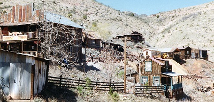
A railway line into the Black Hills reaches Jerome (population 4500 in 1907), which depends for its wealth upon the United Verde copper mine and other mines in the vicinity.
Wickenburg is a junction point on the Arizona and California Railway, and is the central point of a rich gold-mining district.
Globe (population 8500 in 1907) is an enterprising city in the center of an important copper district, containing many mines, of which the principal producer is the Old Dominion, which operates large smelters. The products of these mines, as well as many mountain cattle, are shipped out over the Gila valley branch of the Southern Pacific, which passes through the rich agricultural valley of the upper Gila.
This valley is one of the most important farming sections of the Territory, and here we find Solomonsville and Safford with flouring mills, also Geronimo, Pima, and Thatcher.
Near the eastern boundary of the Territory are three of the busiest towns of Arizona. Clifton with 6000 inhabitants, Morenci with 5000, and Metcalf with 2000, are but a few miles apart, and are built among the mines of a rich copper district, the second in Arizona in point of production. Although built on the steep sides of the canyons of San Francisco River and Chase Creek, they have many fine buildings and modern improvements. The Arizona and New Mexico Railroad gives an outlet to the Southern Pacific at Lordsburg, New Mexico.
The most productive copper district in Arizona surrounds the city of Bisbee, whose population was 10,000 in 1907. Here are the famous Copper Queen mine and the Calumet and Arizona, which together have produced over $20,000,000 worth of copper in a single year. A branch line connects with the Southern Pacific at Benson, and the ore from the mines is shipped over another railway to the great smelters at Douglas, which in size and capacity are second only to the great Washoe smelter in Montana. Douglas (population 9000 in 1907) is well laid out with broad streets and good buildings, and, besides the smelters, has also large machine shops, foundries, and other manufacturing establishments.
Naco is the shipping point for large copper mines in Sonora, Mexico, with which it is connected by a railroad.
Tombstone (population 2000 in 1907) is surrounded by large silver and gold mines which have been worked for many years.
Wilcox and Benson are important railroad points.
Nogales had a population of 2507 in 1907. It is the county seat of Santa Cruz County, and has important mining and stockraising interests. It is located on the Mexican boundary, and is the chief port of entry for Arizona.
Tucson, in the valley of the Santa Cruz, is the largest city of Arizona, with a population of 20,000 in 1907. It is the base of supply for a large number of mines, and does a large amount of wholesale and jobbing business. There is a fine public library, many fine business blocks, flour mills, and ice works. The Southern Pacific repair shops here are the largest in the Territory. The University of Arizona is located here, and the Carnegie Desert Laboratory is nearby.
In the desert region, the important towns are located in the irrigated sections.
Phoenix, the capital and second city in size, had in 1907 a population of 15,000. It is situated in the fertile Salt River valley, the leading agricultural region of Arizona. It is connected by rail with the main line of the Santa Fe on the north and with the Southern Pacific on the south, and is on the route of the new east and west trunk line. It has fine buildings, beautiful parks, flour mills, planing mills, and ice factories, and ships large quantities of farm products and cattle.
Tempe (population 1400 in 1907) and Mesa (with 1250) are surrounded by fine ranches. Both these towns manufacture flour, ice, butter, and cheese, and ship large quantities of hay, grain, and fat cattle. The Tempe Normal School is a territorial institution, and is favorably situated near the center of population of the Territory.
Yuma (population 2500 in 1907) is the shipping point for the rich farming and fruit-raising district of the lower Colorado River, and is the base of supplies for the mines of the Castle Dome, Fortuna, and other districts.
Source: Supplementary Volume: Arizona, by F. M. Irish, published in 1907
Copyright © 1996- The USGenWeb® Project, AZGenWeb

This page was last updated
02/14/2026